Northern Victoria
NORTHERN VICTORIA
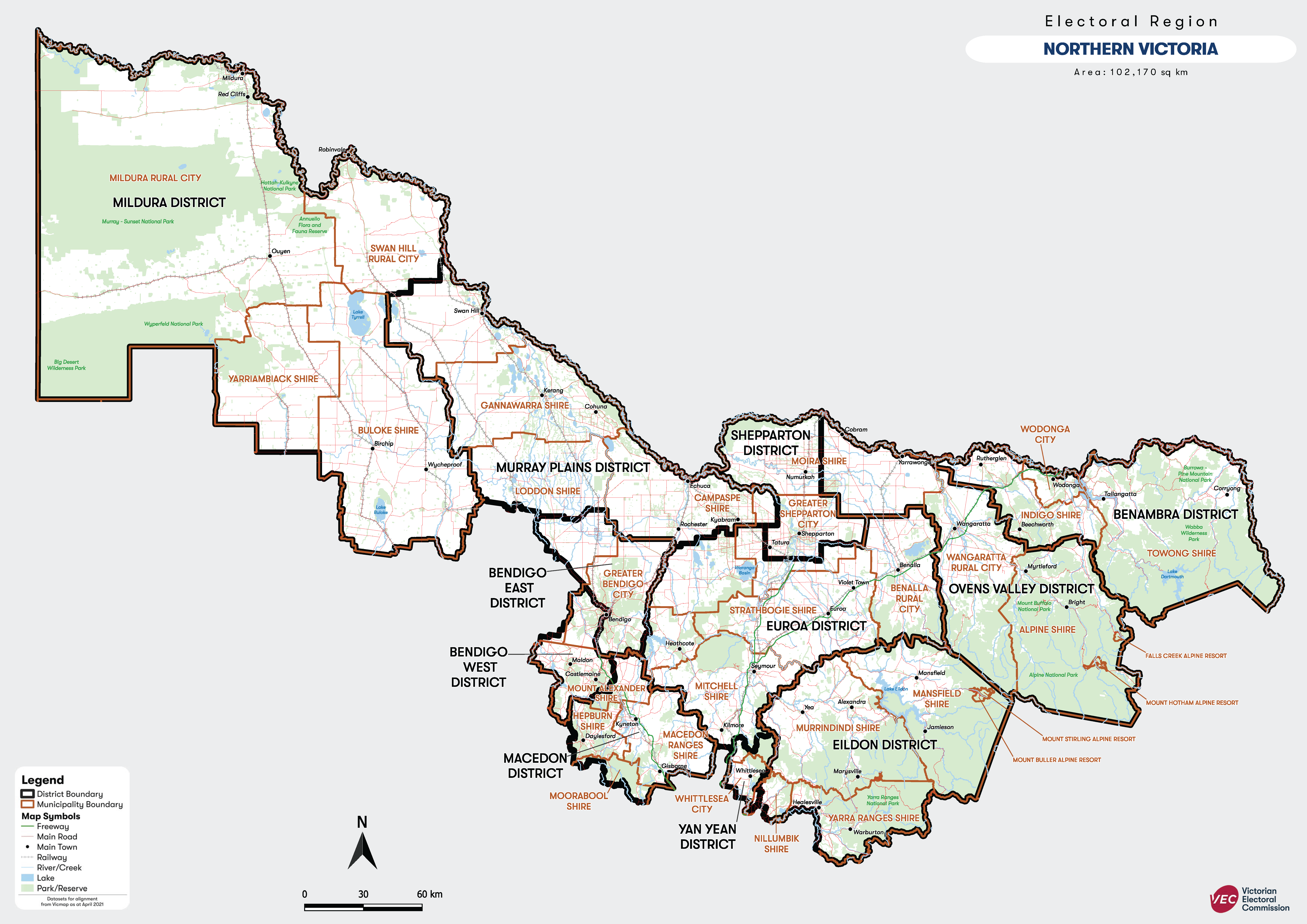
Northern Victoria Region profile
Area: 100,562 square kilometres.
Towns:
Alexandra, Beechworth, Benalla, Bendigo, Birchip, Bright, Broadford, Castlemaine, Cobram, Corryong, Daylesford, Echuca, Gisborne, Healesville, Kerang, Kilmore, Kinglake, Kyabram, Kyneton, Mansfield, Mildura, Robinvale, Seymour, Wangaratta, Warburton, Whittlesea, Wodonga, Woodend, Yarrawonga, Yea
Features:
Northern Victoria Region is a largely rural region that stretches from South Australian border to the upper Murray. Natural features of the Northern Victoria Region include the Murray River, Lake Tyrrell, Lake Hume, Lake Eildon, the Victorian Alps, and the ski resorts of Mt Buller, Mt Buffalo, Mt Hotham and Falls Creek as well as Mount Macedon, Black Forest and Hanging Rock. Industries of the Region include agriculture, tourism, timber production, wine production and fruit growing.
Districts:
Benambra District
Map of the Northern Victoria Region which covers the north of the state. The boundaries include the State Border with S.A. in the west, the Murray River in the north and east, and the boundaries of the Metropolitan Regions in the central south. The map shows the towns of Alexandra, Avenel, Beechworth, Benalla, Bendigo, Beveridge, Birchip, Bright, Broadford, Castlemaine, Cobram, Corryong, Daylesford, Echuca, Euroa, Gisborne, Healesville, Heathcote, Kerang, Kilmore, Kinglake, Kyabram, Kyneton, Mansfield, Mildura, Myrtleford, Robinvale, Seymour, Shepparton, Wallan, Wangaratta, Warburton, Whittlesea, Wodonga, Woodend, Yarrawonga, Yea.